Totford: The Woolpack Inn
A lovely short circular route from The Woolpack Inn via Brown Candover.
Walk Info
Distance from Alton (Miles)
13
Length of Walk (Miles)
3
Duration (Hours)
1.25
Total Ascent (Feet)
180
Grade
Easy – undulating landscape with no stiles. All necessary turns of this clockwise route are described in the instructions below. Unless a turn is indicated, proceed straight ahead.

© Crown Copyright 2025, OS AC0000849864. Terms & Conditions
Nestled in the heart of Hampshire’s picturesque Candover Valley, Totford may be tiny (often thought to be one of England’s smallest hamlet). The landscape here is a patchwork of rolling fields and hedgerows. The circular route is perfect for a refreshing country pub walk.
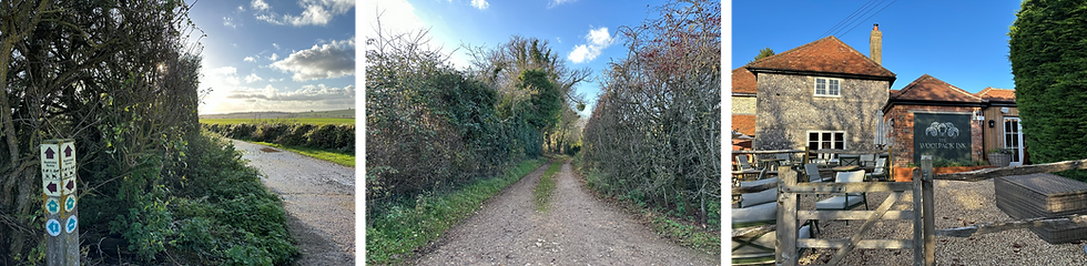
Right at the heart of Totford all sits The Woolpack Inn — a Grade II-listed country pub and inn with a history stretching back to the 18th century, originally serving travellers on the old Drovers’ Trail. Today it’s a celebrated 4-star country inn with seasonal British cuisine, award-winning dining, a cosy bar and a beautiful garden — ideal for a post-walk feast or a leisurely pint.
The Woolpack Inn, Totford near Northington, Alresford, SO24 9TJ https://www.thewoolpackinn.co.uk/
Grid: SU 57091 37946; https://w3w.co/yummy.progress.coffee
The pub car park is for customers only, so please plan to enjoy some refreshments before or after your walk.
Terrain: Varied terrain with mostly gravel footpath. There is a very short section without a verge, that requires walking on the road (B3046) in Brown Candover.
1
Start your walk from the Woolpack Inn car park. Cross the B3046 and take the quiet lane directly opposite the pub. As you make your way up the hill, glance across the fields on your left — on a clear day, you might spot the tower of St John the Evangelist Church in Northington.
After about 0.3 miles, look out for the Wayfarer’s Walk waymarker on your right. The route leaves the road in a sharp hairpin turn, so it’s easy to miss it.
The Wayfarer’s Walk runs from Walbury Hill on the Berkshire–Hampshire border all the way to Emsworth Harbour on the south coast near Portsmouth. This 70‑mile route threads together chalk downs, quiet villages, open farmland and old drove roads, offering long views, gentle gradients
2
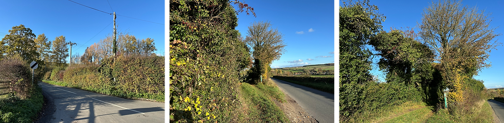
Continue to follow the Wayfarer’s Way straight ahead all the way into Brown Candover.
(Just before you reach Brown Candover, stay on the grassy footpath straight ahead. A wide farm track veers off to the left at this point, but there’s no waymarker, so simply keep going forward to remain on the route. Shortly afterwards, you reach houses and the path merges into a residential lane, simply continue straight ahead.)

3
When the lane meets the main road, continue straight ahead on the B3046. Take care here — the verge is narrow and there’s no dedicated footpath for roughly 250 yards.

4
Very soon you’ll spot an old red phone box ahead. Turn right onto the lane in front of it into Spybush Lane. As the lane begins to climb again, you are on a short section away from the Wayfarer’s Walk.
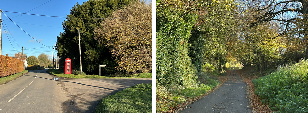
5
At the top of the lane, just after you pass a cluster of large buildings, turn right to re-join the Wayfarer’s Way, heading back in the direction of Totford.

6
At the next junction, just after the large building, take the path that is straight ahead.
The path later merges with a gravel farm track, which leads you back to the B3046, right beside the Woolpack Inn.