Hinton Ampner: National Trust Walk
A woodland walk combined with ridge-ridge top views across open fields
Walk Info
Distance from Alton (Miles)
13
Length of Walk (Miles)
4.4
Duration (Hours)
2
Total Ascent (Feet)
350
Grade
Moderate – The route is crossing fields that may have livestock. All necessary turns of this clockwise route are described in the instructions below. Unless a turn is indicated, proceed straight ahead.

© Crown Copyright 2025, OS AC0000849864. Terms & Conditions
Set within the beautiful South Downs, Hinton Ampner is a wonderful National Trust property and an excellent place to start or finish a walk. With its elegant country house, formal gardens and extensive parkland, it offers miles of scenic routes through open countryside and woodland.
This walk follows the Dutton Estate circular route, taking in sweeping views across the South Downs, open farmland, ancient woodland and impressive beech avenues. In spring, the woodland is especially beautiful, with carpets of bluebells creating a stunning seasonal display.
Visitors to the property can enjoy excellent facilities including a café (with indoor and outdoor seating), shop, second-hand bookshop, toilets, picnic area, free car parking, cycle parking, and dog-friendly estate walks (dogs on leads).
Parking is available on-site for both National Trust members and paying visitors to the house and gardens.
Address: Hinton Ampner, near Alresford, Hampshire, SO24 0LA (Use post code SO24 0NH for satnav); https://w3w.co/tinny.walkway.unusually; SU 59254 27855
https://www.nationaltrust.org.uk/visit/hampshire/hinton-ampner
Alternative Start/Finish: You can also park along the lane at this point (see A on the map). Please park considerately, as space is limited. SU 59836 26998; https://w3w.co/hiding.measuring.daylight; If you park here, turn onto the path on your left as you walk down from the tree‑lined avenue and then follow the route from step 8 onwards.
Terrain: “The route follows varied terrain, mostly alongside fields and through woodland. These sections can be muddy after rain, with a few short stretches on quiet country lanes.
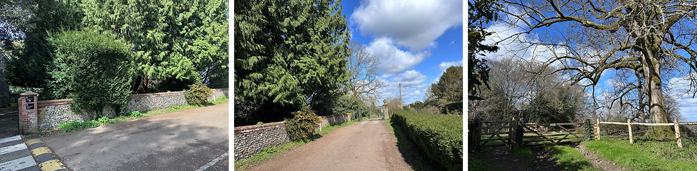
1
The walk begins at the new wooden gate beside the metal gate for the top car park. (If you’re starting from the house, head to the far side of the church and look for the large estate map.)
Go through the wooden gate and follow the path on your right, keeping right as it curves around to another new gate. This brings you out onto a country lane. Turn right and continue past the black metal gate.
2
A little further along, you’ll reach a gate on the left with the Hinton Ampner Estate map, showing all the designated walks
.
From here, the route follows the Dutton Walk (golden‑brown arrows) until you return to this point. Because of the way the trail is signposted, it’s best enjoyed clockwise.
To continue the walk, go through the gate to the left of the large map and follow the arrow pointing straight ahead. Cross the field, being aware that there may be livestock present.

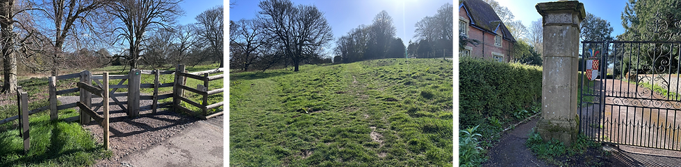
3
When you reach the country lane, through another wooden gate, turn left and then take the track on the right a few metres ahead. Keep to the left at the next work.
Follow the path straight on as it leads you along the ridge.
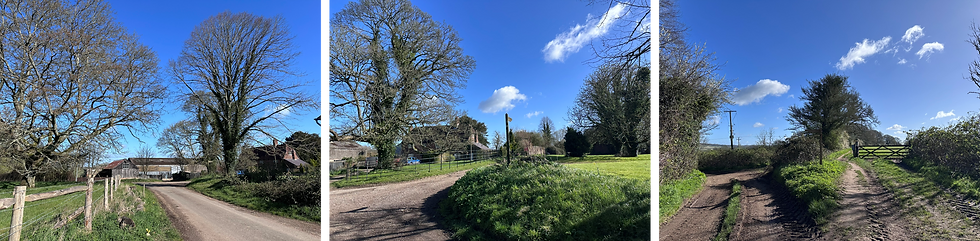
4
Enjoy the splendid views on this section of the path. Just before a small copse, the walk turns right and heads downhill to a country lane. The waymarker here can be a little hard to spot at times.

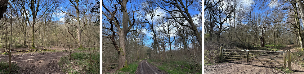
5
Cross the country lane diagonally to your left and follow the path on the other side uphill into Jean’s Acre Wood.
This section is very well signposted, simply follow the waymarkers as they guide you through the wood. In spring, this stretch of woodland is filled with carpets of bluebells, creating a beautiful burst of colour along the path.

6
When you reach the rutted lane, turn right and follow it for a few minutes. The walk continues just by a large wooden gate on your left.
Follow the route uphill into Brooms Wood, and keep to the well‑positioned waymarkers as they guide you through the trees.
7
After you leave the wood, you’ll reach a T‑junction with another footpath. Take the path to your left.
After a short while, you’ll cross a country lane and continue straight ahead on the footpath. If you parked on this lane, this is the point to retrace your steps back to your car.

8
When you reach the section where there are gates on both sides, take the gate on the right and head uphill towards the estate. As you make your way uphill, the estate will begin to appear on your left. You may encounter livestock in this field.

9
At the end of this short climb, you’ll arrive back at the gate that was next to the large estate map at the star. Go through this gate on your left and follow the road to the right.
After passing the black metal gate, you’ll see a new wooden gate on your left.
Follow the path, keeping to the left, to retrace your steps back to your car.