Bentworth: The Sun Inn Pub Walk
UNDER CONTRUCTION
Walk Info
Distance from Alton (Miles)
4
Length of Walk (Miles)
5
Duration (Hours)
2
Total Ascent (Feet)
320
Grade
Moderate – undulating landscape with three stiles. The route is crossing fields that may have livestock and horses in them. All necessary turns of this anti-clockwise route are described in the instructions below. Unless a turn is indicated, proceed straight ahead.
© Crown Copyright 2025, OS AC0000849864. Terms & Conditions
This circular walk around Bentworth offers a rewarding journey through the rolling Hampshire countryside, blending open farmland, peaceful woodland, and views. You can expect gently undulating countryside, offering a mix of fields, hedgerows, and seasonal interest throughout the year. Particularly around April, walkers can expect bluebells on the wildflower verges of the Oxdrove Way and in Gaston Wood.
The walk starts and finishes at The Sun Inn a typical charming countryside pub. The 17th-century pub tucked away down a quiet lane in the heart of rural Hampshire. Brimming with character, it offers a warm and welcoming atmosphere, complete with low wooden beams, open fireplaces, and rustic interiors that reflect its long history. The pub serves everything from hearty comfort food alongside a great selection of local ales and fine wines. The Inn is an inviting stop for a relaxed lunch, a cosy evening meal, or simply a drink outside or by the fire.
The Sun Inn, Well Lane, Bentworth, Alton, Hampshire, GU34 5JT https://www.suninnbentworth.com/Grid: SU 67078 40258; https://w3w.co/typically.legs.tougher
The small pub car park is for customers only, please book your table in advance and let the pub know if you go for a walk before or after.
Alternative Start/Finish: Parking is also available by the St Mary’s Church (start with Step 2 in the walk description) and the village green (start with Step 3).
· St Mary’s Church, Church St, Bentworth, Alton GU34 5RE; https://w3w.co/forgives.gazes.vessel
· Bentworth Village Green, (junction of Village Street, Church Street and Holt End Lane); https://w3w.co/carriage.quoted.confirms
Terrain: Varied terrain with mostly footpaths through fields, farm tracks and bridleways. Short sections on country lanes.
1
With the Sun Inn behind you, turn right and head up the hill, following the road to the crossroads. This stretch can be busy, so stay aware of passing cars.
At the crossroads, look straight ahead to spot a rare Edward VII postbox, then take the wide footpath just to its right.

2
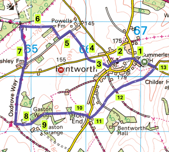
Follow the path alongside the fence and through the wooden gate into the churchyard. You might like to pause here to explore St Mary’s Bentworth, a beautiful old flint church.
When you’re ready, leave the churchyard through the gate nearest the main entrance and continue straight ahead to re-join the road.

3
After about 100 metres (110 yrd), you will see the village green on your right, marked by a large oak tree and a cluster of benches.
Walk through the wooden kissing gate that in the hedge edging the Village Green (North West corner).
Follow the footpath across a small meadow with young fruit trees, pass through a second kissing gate, and continue diagonally across the next field to a third wooden kissing gate.
4
Continue diagonally across the next field to a third wooden kissing gate. Here do the same and continue diagonally across the next field until you reach an iron bar gate.
Pass to the left of it, then cross the quiet country lane (Ashley Road) to another iron bar gate opposite. Pick up the footpath again here and follow it straight ahead.

5
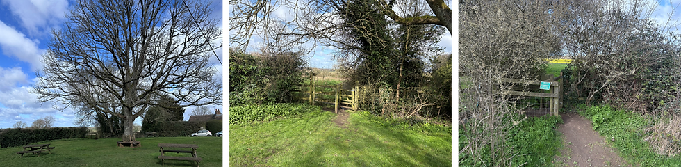
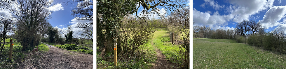
For the next section of the walk, follow the yellow footpath signs as they guide you around the edge of the fields, keeping to the ‘no access’ private‑land signs where they appear. The route includes a 90‑degree left turn beside the horse pastures, followed by a 90‑degree right turn uphill along a broad, deeply rutted farm track.
6
At the top of the hill, after about 250m (275yrd), turn left — the land straight ahead is private. Follow the narrow footpath diagonally across the large field for roughly 600 m (660 yrds). Take care not to drift onto the wide farm track running along the hedgerow on your right.
When you reach the far side of the field, slip through the gap in the hedge onto a broad track called Bullfield Lane, part of the ancient Oxdrove Way.Turn left here to continue the walk. Depending on the season, this stretch is often lined with bluebells and other wildflowers, adding a lovely splash of colour to the walk.

7
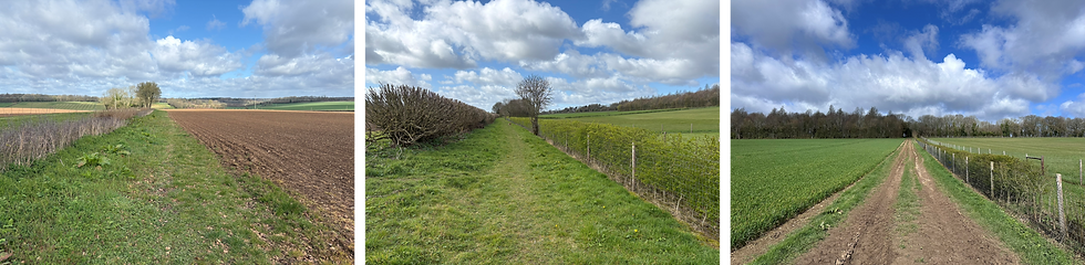
When you reach the wooden barrier, continue straight ahead onto the concrete farm track, bearing slightly left. Follow this track as it carries on and eventually merges with a quiet country lane. Be mindful when crossing here — there are two blind corners, so take a moment to check for traffic before continuing.
The Oxdrove Way continues where the road makes a 90‑degree left turn beside a large iron gate — aim for the red‑and‑black ‘No Motor Vehicles’ sign. Go through the gap to the right of the gate and you’ll join another ancient track known as Dirty Lane.
8
When you reach a junction of several footpaths and bridleways, ignore the wide gravel tracks. Instead, look for a small gap in the hedge on your left and take the narrow footpath (yellow arrow) up into the meadow, keeping the deer fence on your right as you climb.
9
A little further on, through a wooden gate, you will enter Gaston Wood, which is beautifully carpeted with bluebells in spring.
Keep straight ahead at the first crossroads (there’s no waymarker here), then take the right‑hand fork a little further on, marked with a yellow arrow.
Follow this path through the wood for about 150m, where it bends gently to the left. Continue for another 25m until you reach a gap, emerging out onto open fields.

10
As you reach the end of the field, continue across the rutted track diagonally to the right; and then follow the path again diagonally to the right through a small wood. This section is well signposted with yellow footpath arrows, so it’s easy to stay on course.
After leaving the small wood, you’ll emerge into another field. Cross it diagonally to the right for about 300m until you reach the far side.
Follow the path as it turns right along the field edge and continue until you reach a metal gate leading out onto the road.

11
When you reach the road (Holt End Lane), aim for the white sign diagonally to your right, pointing towards Beech Copse. This is the main Bentworth–Medstead road, so take care when crossing — traffic can appear quickly.
Follow the gravel track; just before the private drive, turn left down a narrow path with a fence or hedge on each side.
Continue along this path and cross three stiles through open pastures, where you may encounter horses or other livestock. After the third stile, continue straight ahead on the footpath, crossing the track and carrying on in the same direction.

12
Keep following the footpath straight ahead, including where it drops down a short flight of steps. Continue your walk as the path bears diagonally to the right to meet Tinker’s Lane.
13
At the end of the large field, the path bends left. Just after the metal gate on your right, slip through the gap next to it to reach the road (Well Lane). Turn left here to return to the Sun Inn.
